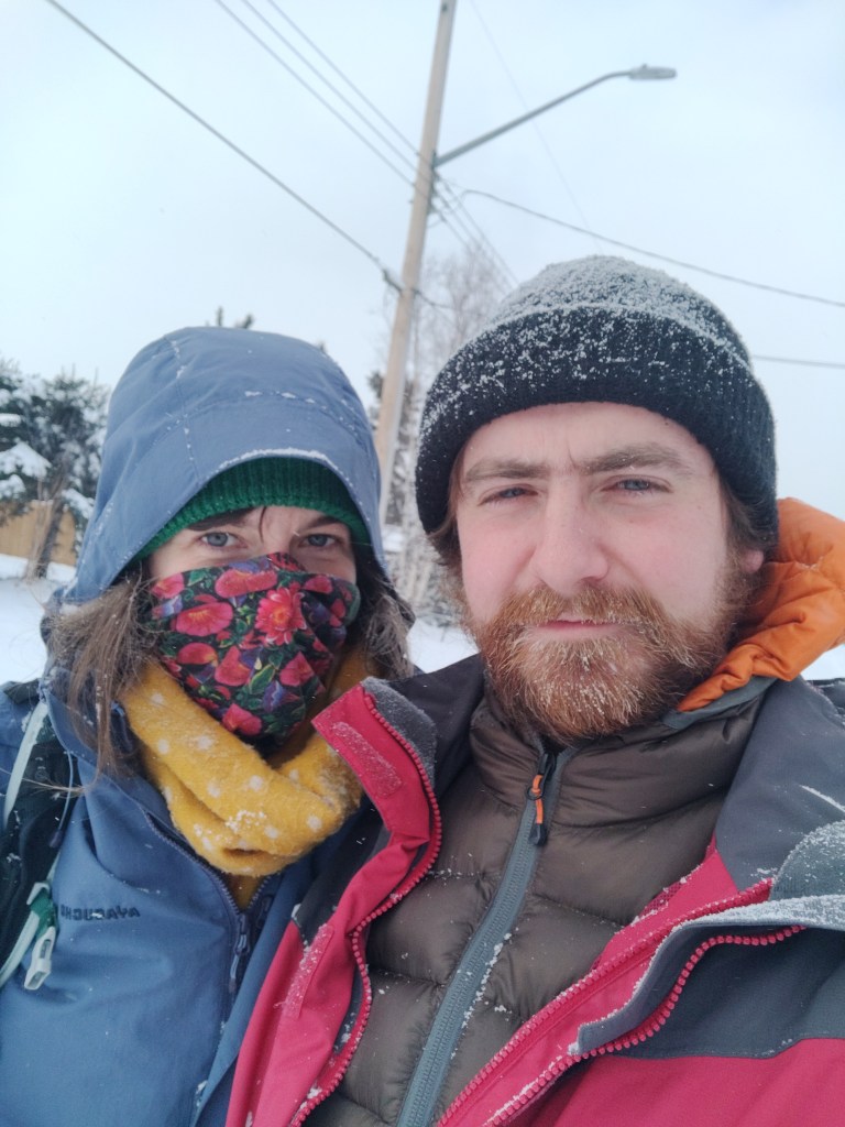
It’s been a while since I’ve posted on this blog. We got back to the UK in mid March and a combination of busy-ness (& business!), illness (man flu) and generally the fact that there were more productive things to be getting on with has meant that this final post has taken a while to finish – sorry!
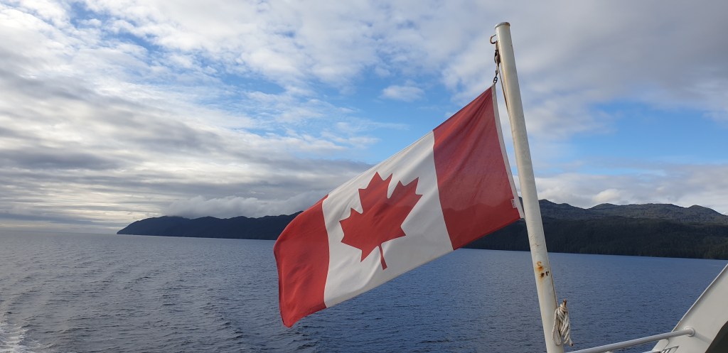
We got the ferry early in the morning from Port Angeles in Washington to Victoria on Vancouver Island, British Columbia. Of the five border crossings we’ve done since leaving home, this was by far the easiest. When we boarded the ferry, the border officers made it very clear that: (a) bringing fruit and vegetables into Canada is not allowed and (b) bringing firearms into Canada is also not allowed (but maybe not quite as important as fruit and vegetables). We had some oranges in our bag but lied outright so we could save money on our next lunch.
We made the short hop from Washington to Vancouver Island on a 1959 ferry called MV Coho. When we docked, the ferry’s sound system played the MV Coho’s own theme tune, sung by Bing Crosby (look up Black Ball Ferry Line on YouTube). We met some nice Texans on the voyage.
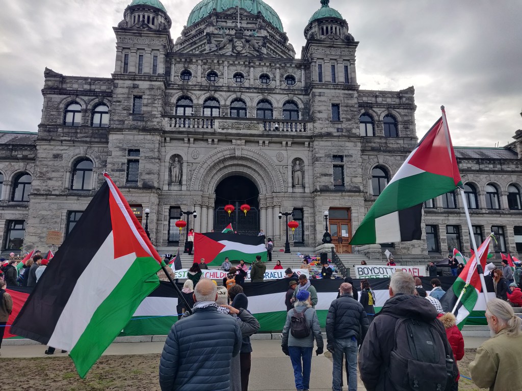
Victoria felt intangibly different from the USA – maybe it was the shared love and reverence our respective countries feel for our joint King. I think after the USA, you feel a connection with people in any other country – we’re all jointly not American. Maybe it was our general sense of homesickness, but the streets felt a little bit more safe, more walkable, the car felt a bit less dominant in the city. Parking (we’d picked up a new car for Vancouver Island) was more restrictive – in the USA, you can basically just leave your car where you like. We had only three nights on Vancouver Island, so after we picked up our car we had a look around the Victoria museum and at the pro-Palestine gathering at the Provincial Legislature (Victoria is the capital of British Columbia and therefore its political centre) and then headed out to see the island.
There are lots of totem poles in British Columbia (BC). There are a lot of examples of native art in general, and it’s a very attractive form. It’s quite simple but very expressive and it hinges around a limited set of animal shapes which form the basis of the various myths and legends of the First Nations cultures. The artistic style is common across BC and there are various museums exhibiting the art and history of local tribes, as well as practising craftsmen (and it was almost always men) selling three-dimensional and relief sculpture in the local forms.
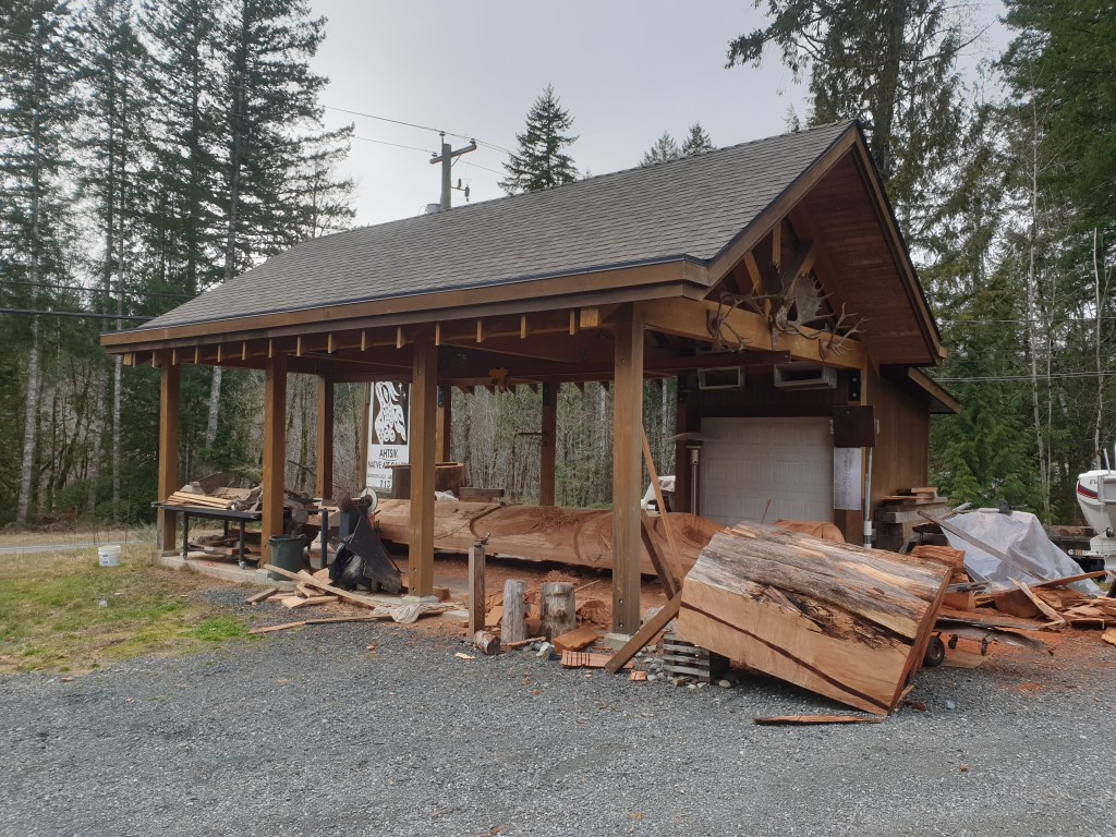
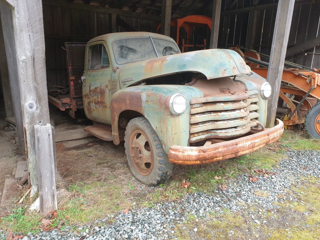
We had three nights on Vancouver Island – two nights in Qualicum Beach, a third of the way up the Island, and one night in Port Hardy, right at the northernmost point. As we were time-limited, we were picky about where we visited. One of our stops was at a restored sawmill – McLean Mill, at Port Alberni. It’s an amazing site and as we visited in the winter there was no-one about. It’s basically an entire functional late 19th Century sawmill which operates for visitors during the summer. Logs are winched out of the log pond, set, milled, edged, planed and stacked all within one operation. Logs were placed in the pond by various vehicles including a (fully operational) steam donkey and a series of very old Chrysler pickup trucks which were rusting away in the garage.
As an aside, the amount of Lobaria pulmonaria (Lb) lichen (lungwort) was incredible. In the UK, Lb is an indicator of ancient, temperate rainforest and is rare; finding a hand’s breadth on the woodland floor would be notable. In BC it’s everywhere, seemingly raining from the forest canopy.
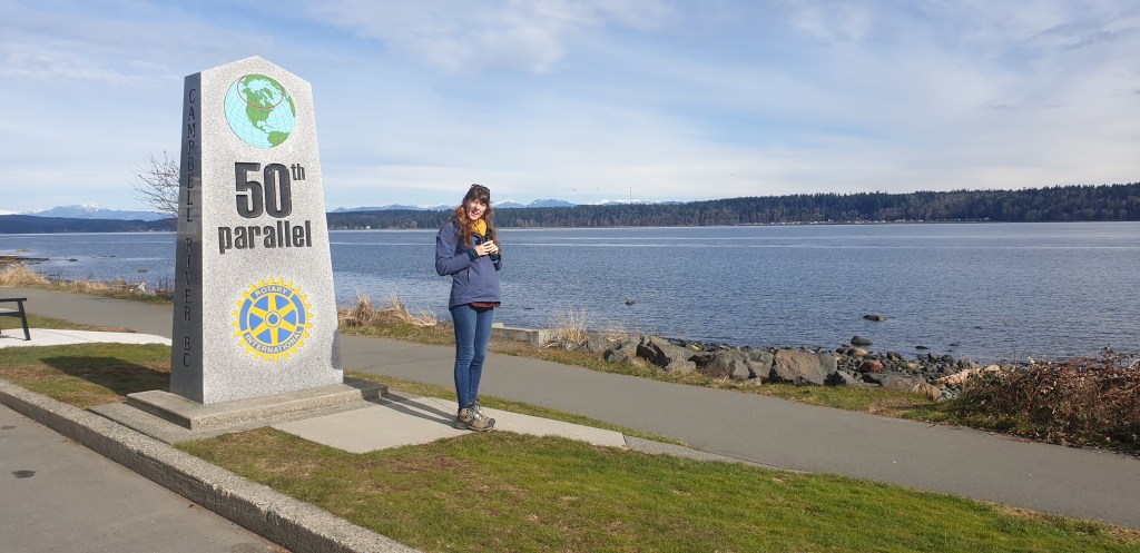
We drove past the 50th parallel, which was a good indicator as to how far we’d come. At Guerrero Negro in Mexico, our southernmost point, we were at about the 27th parallel north – about 1/3 of the way from the equator to the North Pole. The 50th parallel north represents just over half way to the North Pole from the Equator. In Old World terms, the 27th parallel north is equivalent to places in Egypt, Saudi Arabia and Iran. The 50th parallel north goes through parts of Normandy, Belgium, northern Germany and Poland. Cultural differences are so comparatively small in North America (at least on the West Coast) that we’d barely noticed changes going northwards – barring the Mexican and Canadian borders. Bear in mind we were now in a land of temperate coniferous rainforest and we still weren’t yet at the latitude of Britain.
Every beach, all the way from Northern California to Vancouver Island, was swamped with driftwood. This wasn’t the type of driftwood you’d get in the UK, but huge tree trunks – in California and Oregon, these included massive redwood trunks.
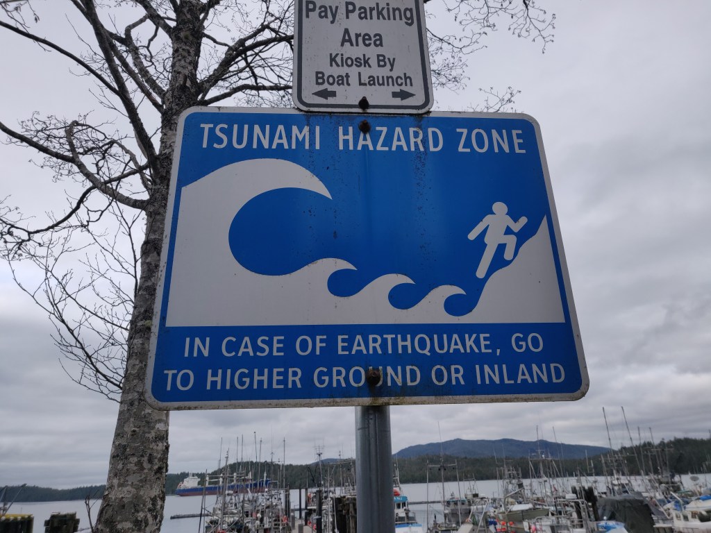
As you drive up the North West coast of North America, you drive in and out of ‘Tsunami Hazard Zones’ as you drive up and down inclines in the road. Seemingly based around contour lines, these represent the points you need to get to in the event of a Tsunami. At various points in towns along the coast, there might be more detailed signs showing which neighbourhoods are at risk for a particular type of Tsunami (originated close by or more distant and therefore weaker or stronger).
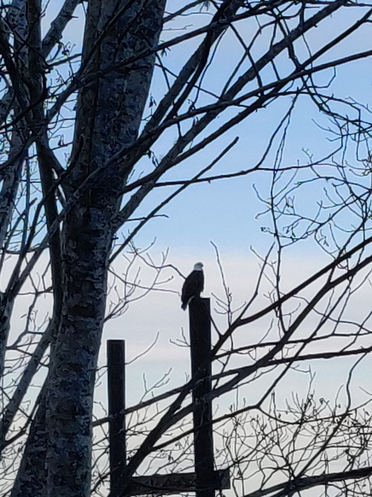
Bald eagles are everywhere – equivalent to buzzards in South West England in how common they are. They’re fishing birds, so find a perch overlooking a bay or inlet from which to watch for prey. We would often see three or four at a time in various trees and telegraph poles.
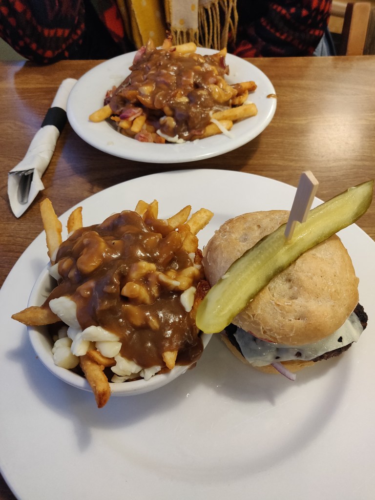
Alongside our usual food, which tended to be the cheapest bearable food we could find – tortillas and salsa, wraps and cheese, packets of salad – we tried the occasional food ‘out’ as they say. In Canada, the local delicacy seemed to be Poutine. Poutine is chips with cheese curds and gravy, and it’s as healthy and wholesome as it sounds. As in the USA, portions are generally larger than you’ll ever need so my advice if you’re going would be to order less than you think you want!
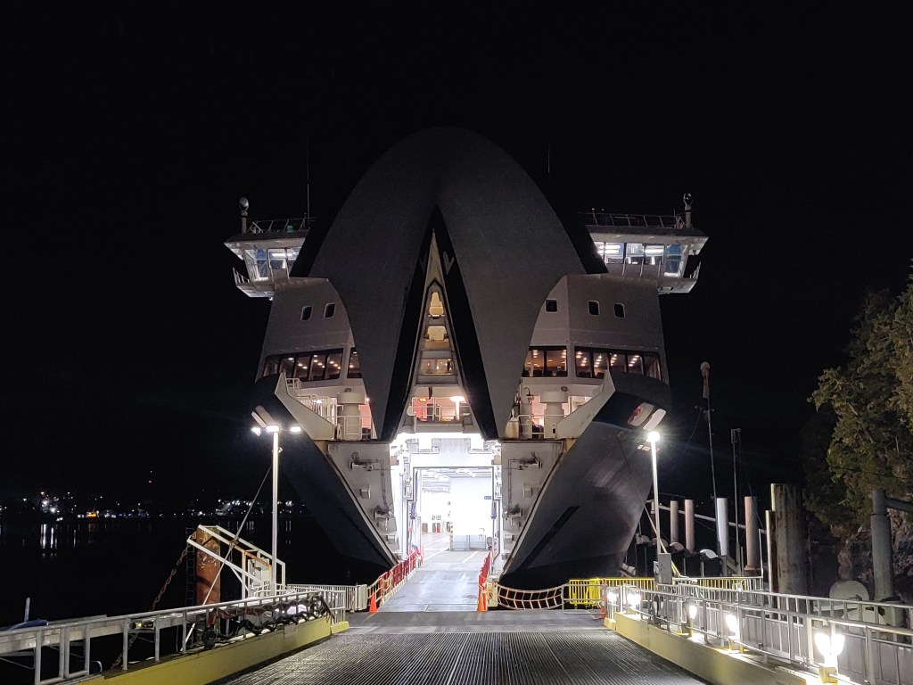
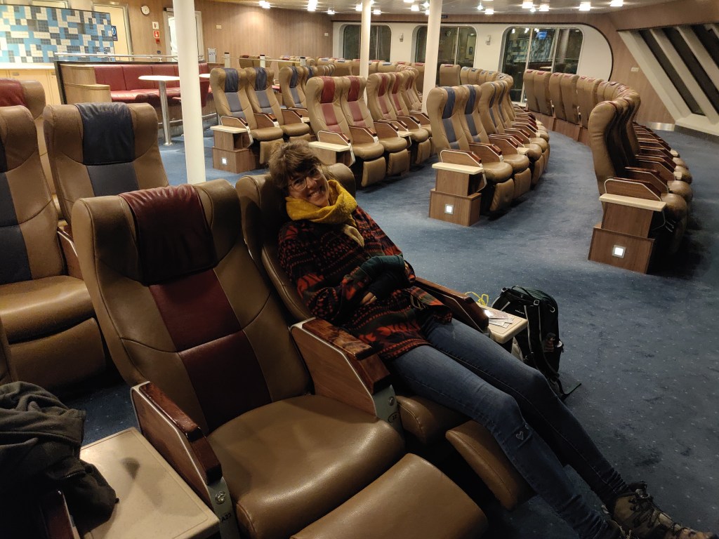
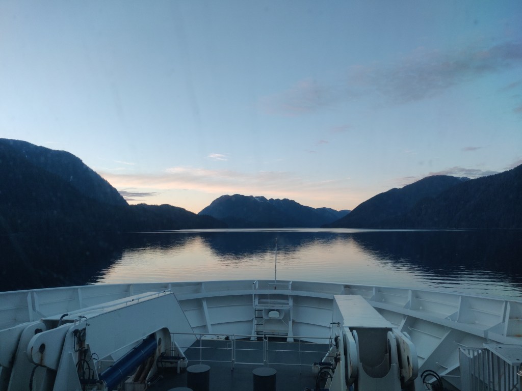
We took a ferry from Port Hardy, the northernmost ferry port on Vancouver Island, to Prince Rupert, the northernmost town on the west coast of Canada. The ferry was to take about 18 hours and the route was to take us on the Inside Passage via and around the various islands which litter the NW coast. The ferry was called ‘Northern Expedition’ and from reading the specification it had 55 staterooms, a café, a restaurant, and a few other things. When we were on it, there were around 70 passengers and about 60 got off half way at a settlement called Bella Bella. This was on an island with no road connection to the mainland – the ferry was the only way to get there. The town of about 1500 people is part of the romantically named Bella Bella Indian Reserve No. 1 and is the main home of the Heiltsuk First Nation. The whole area was dominated by the fishing and canning industries until a few decades ago, and the local economy is apparently still coming to terms with the end of that industry. After Bella Bella, we were virtually alone on the ferry for the next 12 hours or so as we drifted up the Inside Passage.
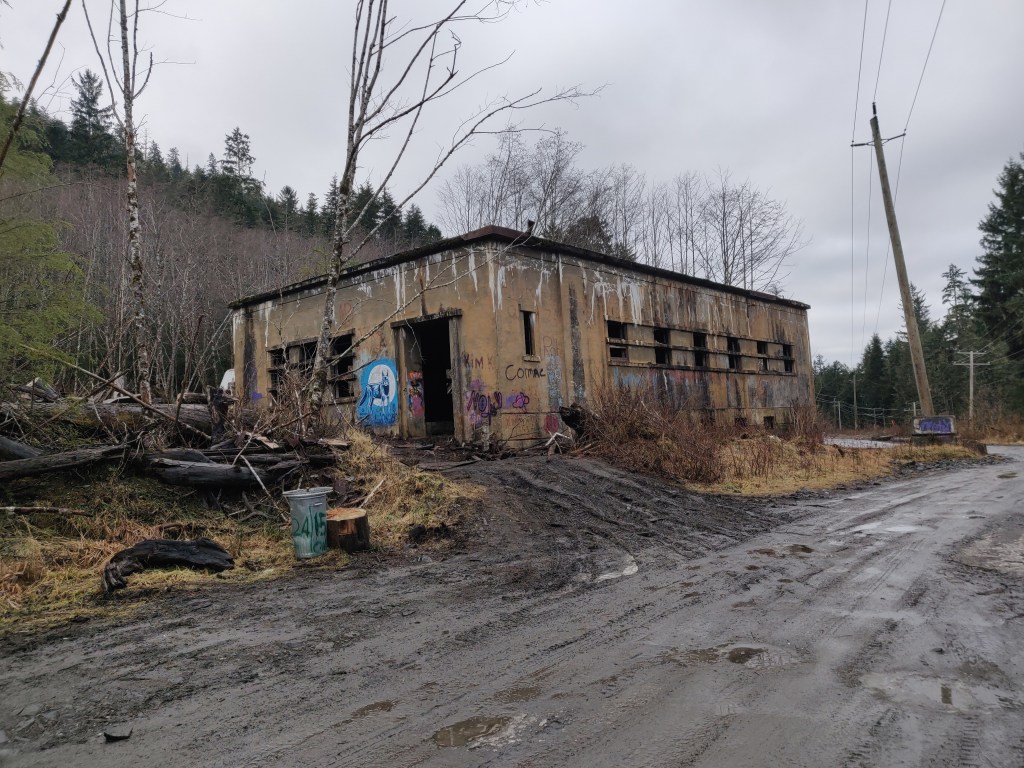
The ferry moored in Prince Rupert late at night, and we managed to find a taxi to take us across town to our accommodation for the next three nights, a small B&B. We’d got the impression before arriving that Prince Rupert (PR) was an attractive small port and a nice place to spend time, but it turned out a bit more mixed. The town has been developed as a main port for international trade as it’s at the end of one of Canada’s main train lines and is further north (Shanghai – PR takes 11-12 days as opposed to 13-14 days to Seattle). The town was part industrial, part generic run-down North American town and part nice seafront. The museum was very interesting, with lots of First Nations artefacts. We went for a walk up the mountain and experienced some Canadian footpath mapping. We followed a local map from a book; the trail we were on soon disappeared under an avalanche of windblown trees and seemed to have no relation to the map we were following. We ended up abandoning that route and following a local footpath through a local dump and a forest where we were dodging broken bottles and puddles of toxic-looking waste underfoot.
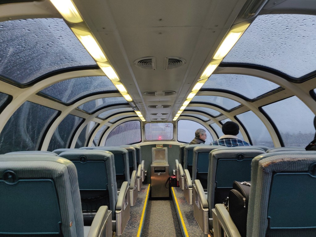
After a couple of days in Prince Rupert we got on the train. From PR it goes up the elongated valley of the Skeena river and down a few more valleys towards the town of Prince George 300 miles inland and ultimately Jasper in the Rocky Mountains. I mention Prince George because the train stops there, you get off and stay the night, and then you get on again in the morning. The train itself is impressive; there are only a couple of carriages but the rear one has a viewing platform on top with panoramic views. We managed to see some otters sliding on the ice and a lot of frozen rivers and forest, but unfortunately no other animals.
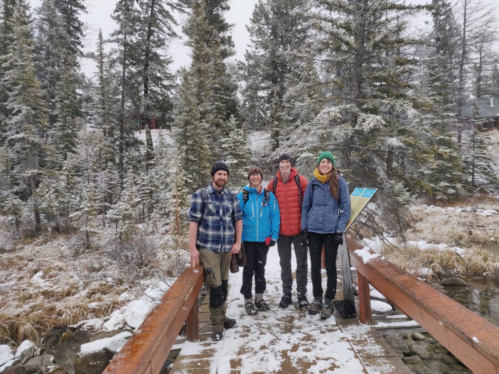
We were collected from the station in Jasper by Sarah’s Aunt and Uncle, Lizzie and Andy. We stayed at their friends’ cabin, a fantastic house in a place called Brule close to Jasper (thanks Brian and Lisa for letting us stay!). This was where we first experienced truly low temperatures on our trip – below -20C. We did a few short walks around the area (we couldn’t do much more with the weather) and after a few days we went with Lizzie and Andy back to Jasper and turned southwards through the Rockies and towards the Icefields Parkway (Alberta Highway 93) and Banff, one of Canada’s most famous resorts.
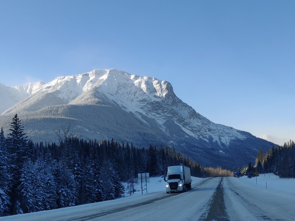
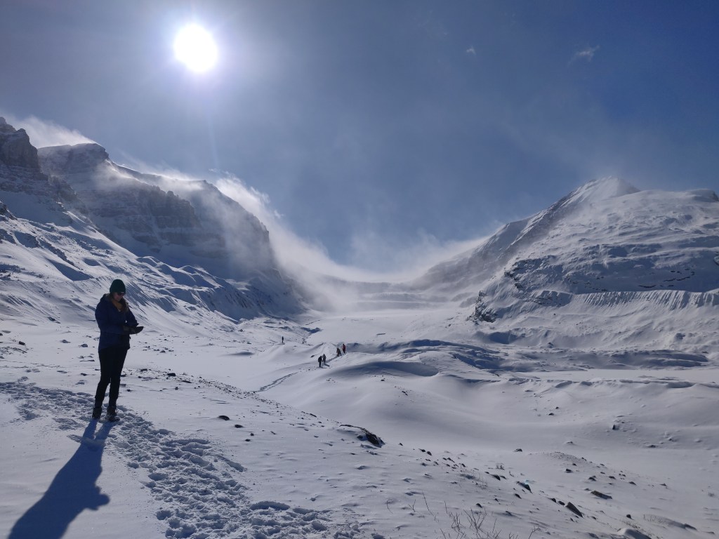
The road through the Rockies was spectacular. Lizzie and Andy’s car emulated the train we’d taken with its panoramic sunroof (though this was largely frozen over for most of the journey). With snow tyres it was possible to maintain near-normal speeds on the snow-packed roads and get in an out of untouched snow-covered laybys without an issue. The Icefields Parkway runs along the Continental Divide and is named after (among other lesser icefields) the Columbia Icefield, which gives birth to various glaciers around its circumference. The most spectacular of these which we saw was the Athabasca Glacier (part of the Columbia Glacier). There’s a hotel by the road and a few signs and old photographs making you aware that the glacier used to end by the road; in a century it has retreated several hundred metres. It’s still spectacular and a potent reminder of the power of frozen water.
We stayed just south of Banff in a place called Canmore for three days. From here we did a few walks, including one along a completely frozen river, using spikes and crampons. We also visited a couple of resorts with frozen lakes where people were walking, skiing and playing ice hockey. At Banff we went to the curated hot springs, an outdoor swimming pool which is fed directly by water which came out naturally at 38 C – a strange experience in an outdoor pool when above the water line temperatures were below zero and snow was falling!
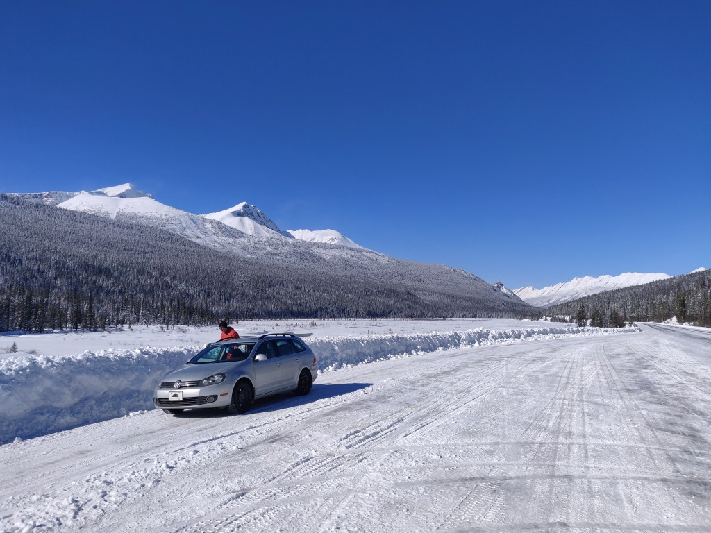
We drove (well, Andy drove) back to Edmonton. Once we left the mountains we were driving on a nearly flat plain, heavily farmed and fenced and quite sparsely populated except for the areas immediately adjoining Calgary and Edmonton. On the way we passed through a weather front, going from around +7 C to -8 C in less than four minutes with the windscreen noticeably icing up in seconds.
Lizzie and Andy have a nice house in southern Edmonton, on a quiet road but close enough to the city to be within walking distance or a short bus journey. We stayed in Edmonton for about twelve days and saw a few things the city had to offer, within the limits of the very low temperatures. Time outdoors had to be limited at -30C, so we’d have to make sure we left for the bus at exactly the right time so we wouldn’t start to freeze at the bus stop. We went to the local museum, called (pleasingly for Exeter people) the Royal Alberta Museum, or RAM. We also went to an indigenous exhibition about the native people of the Edmonton area and the various ambiguously defined ‘Numbered Treaties’ between them and the Crown, which are still the basis of relations between indigenous groups and the federal Canadian government. There are clearly many unresolved issues between the rights of the native people and the state of Canada, but the relationship seems to be a more complex and mature one than that between the USA and its reservations.
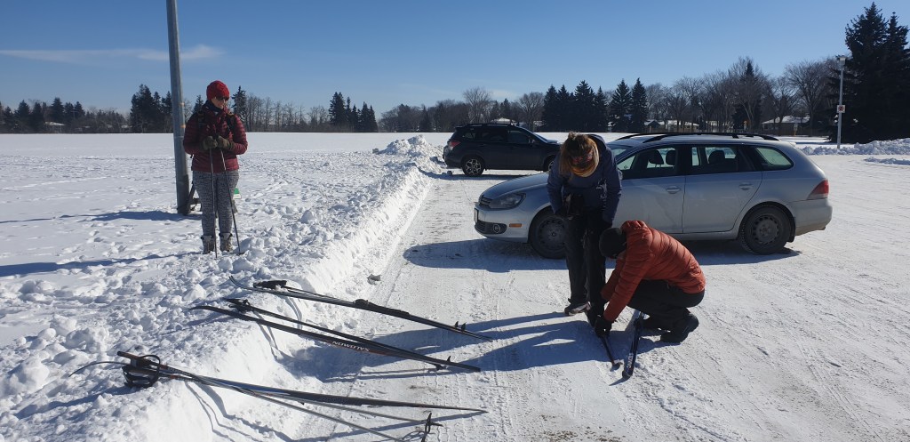
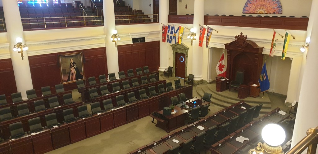
We also went skiing – Sarah’s first time and my first since attempting it in Norway. Cross country skiing is something people who are good at it make look effortless, but neither of us were quite at that level. We visited a nice pub/ microbrewery, a cowboy boot shop and a fantastic tool shop. We also visited the Alberta parliament building and had a tour, which was very interesting.
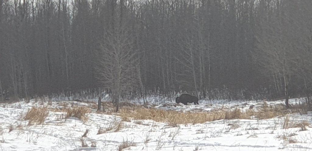
The last place we visited was Elk Island national park, not far to the east of Edmonton. We went for a walk in the snow (by this time it had warmed up significantly from -30 ish to around -5) and saw lots of beaver activity and one of North America’s last and biggest herds of buffalo (really bison). We had to look from a distance as they can be very dangerous if you get too close; the advice is that if you stick your thumb up in front of you with your arm straight, the bison should be hidden by your thumb. Presumably people with bigger thumbs are better able to defend themselves from bison.
We flew back to the UK in mid March via Calgary (no airline issues this time thankfully!) and got a coach from Heathrow to Exeter. It was a bit of a shock driving on the left again, and it was great getting back to the rain and the green. We were away for long enough (around ten weeks) that it took a while for us to get used to the UK again, a feeling I’ve always loved as it’s a great opportunity to see your country from a new perspective and it’s a sensation which inevitably goes away too soon.
I plan to do another ‘epiblogue’ to sum up our experience and our impressions of the three countries of North America and what it was like doing that journey from Mexico to Canada by road. We did and saw a lot but there’s a hell of a lot we wanted to do which ultimately didn’t happen because of limitations on time and money.
Hopefully it won’t be another four months until the next post!